Happy feet: Put your best foot forward with some of our favourite walks

Aussie walkers are well and truly spoilt for choice when it comes to putting their best foot forward on a boot-borne adventure, whether it is a day walk or multi-day epic. In this short excerpt from Issue 11 of Aus Geo ADVENTURE, on sale now, we reveal some of our favourites.
Thorsborne Trail, QLD
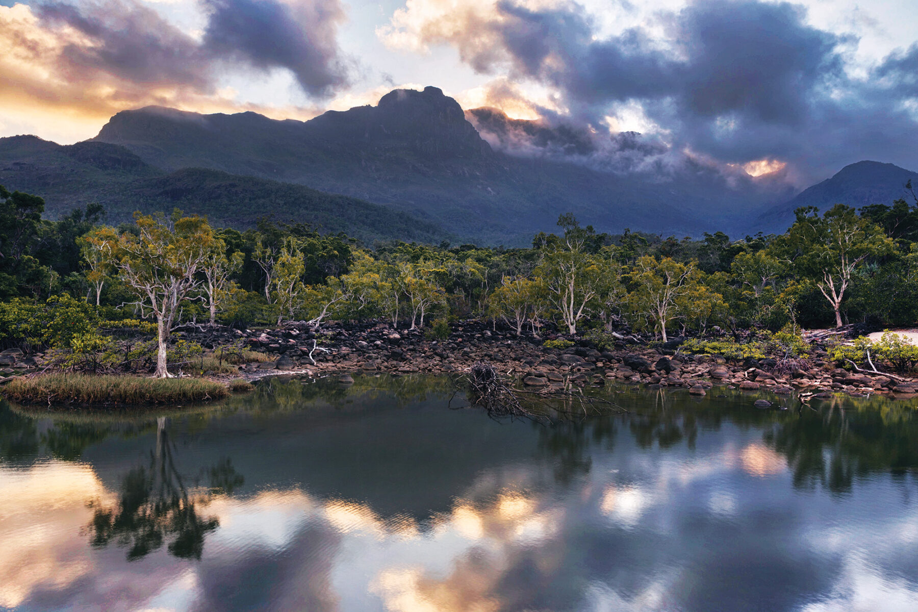
Thorsborne Trail on Hinchinbrook Island is one of Australia’s great multi-day walks, providing walkers with a real wilderness experience. Only 40 people are permitted on the track at a time so you can enjoy the solitude of a relatively untouched landscape. There are few traces of human interference here. Apart from track markers, fixed to trees at eye height in the scrubland and rainforest sections, there is very little signage. Walkers must camp and be entirely self-sufficient.
Hinchinbrook Island, 53km long and 10km wide, located about 6km off the northern Queensland coast, is part of the Great Barrier Reef World Heritage Area. Water is a defining feature of the landscape on the island – its rugged 400sq.km landmass has been shaped by the seasonal rains and tidal swells of the Wet Tropics. An intricate network of creeks and waterways threads across the island; swollen with monsoon rainwater during the humid summer months, they give birth to falls that thunder through the island’s rock country. During winter the waterways gradually drain and evaporate, leaving many creeks dry.

The Thorsborne stretches 32km along the eastern coast of the island, from Ramsay Bay in the north to George Point on the south-eastern tip and can be walked in either direction. The trail passes through incredibly diverse landscapes, traversing mangrove swamps, sweeping beaches and rocky headlands on the Coral Sea, heath-covered mountains, melaleuca and palm wetlands, eucalypt and casuarina woodlands, and lush, tropical rainforests. Although daily distances are short, it’s a challenging walk thanks to the humidity, the need to carry your own gear and water, tidal creek crossings and the danger of saltwater crocodiles and marine stingers. Nevertheless, the island’s wild and pristine beauty is hard to resist, and you’ll soon see why people come from all over the world for the Thorsborne. Camping permits must be obtained from QPWS. Plan well ahead as this is a popular walk.
kunanyi/Mt Wellington Circuit, TAS
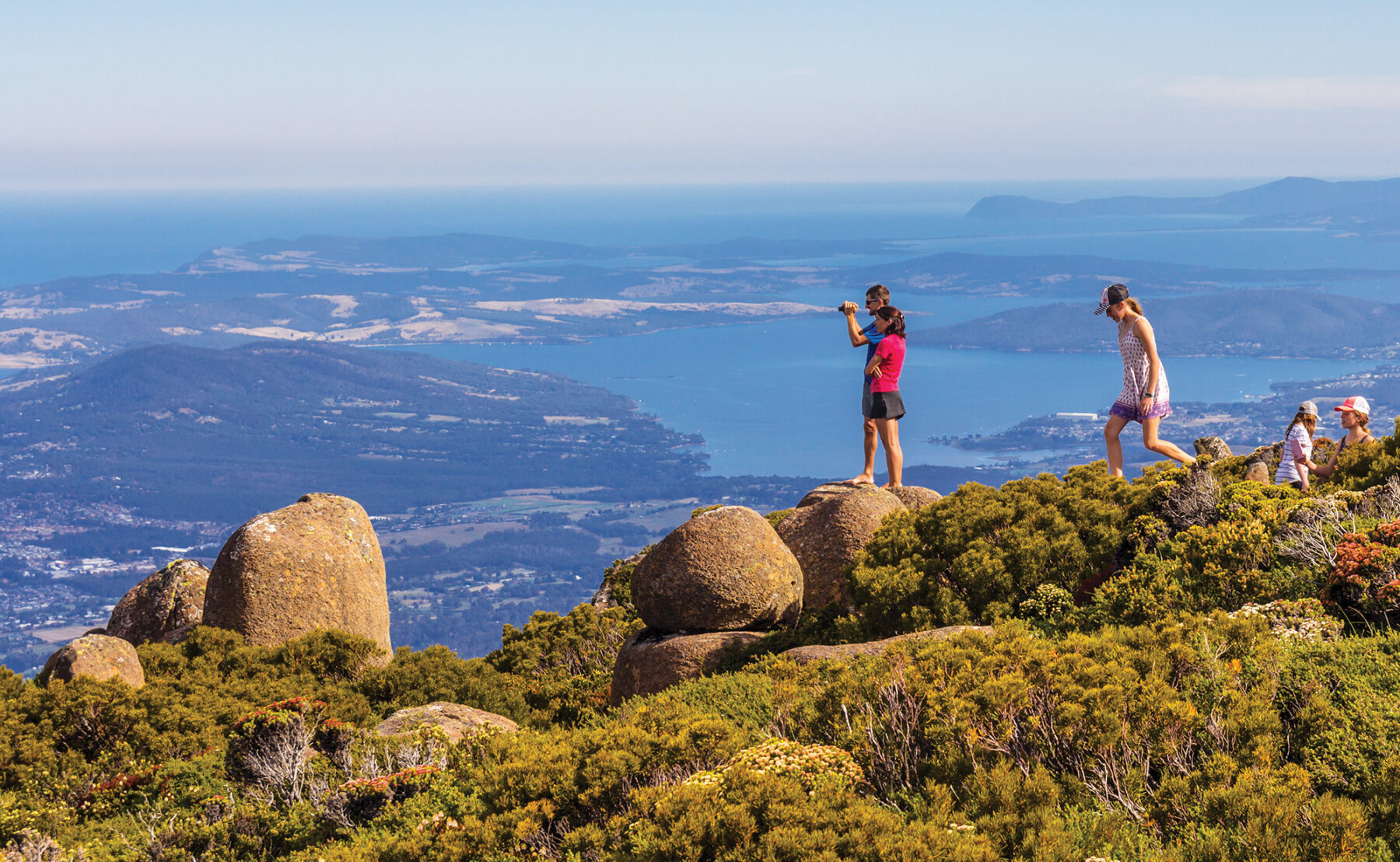
The imposing bluff of kunanyi/Mt Wellington(1271m) looms above Hobart, often with its tip dusted with snow or swirling with mist. In fine weather this walk promises you breathtaking views of Hobart and its environs. You will pass through some beautiful vegetation communities and have the chance to see Mt Wellington’s dolerite cap, with its natural rock sculptures, up close. Combining several existing tracks, this walk begins at the Springs car park and takes the Pinnacle Track to start with. Panoramic views of Hobart begin to open up as you ascend to a junction with the Zig Zag track, marking the start of a stiff climb up to the summit. This steep and rocky path is protected by guideposts and chains, with fine stone walls and steps close to the top. In November and December, you will see the red Tasmanian waratah flowering in profusion. You will also see alpine plants, such as pineapple grass growing along the track. The snow gums become sparser and shorter as you approach the tree line. Soon you’ll catch your first sight of the Organ Pipes and the summit ahead, where you’re likely to be blasted with chilly winds while you admire the views of Hobart, the Derwent River and southern Tasmania.

The route descends via the less defined South Wellington track leading across alpine heathland that is strewn with well-weathered dolerite tors and boulders of truly sculptural quality. The mountain’s numerous springs have always provided abundant, clear drinking water, and even ice in the days before home refrigeration, as evidenced by the 19th-century huts on the Ice House Track, before returning to your start point. Weather on Mt Wellington can change rapidly; make sure you are prepared for all conditions.
Wonderland Loop, VIC
Grampians National Park, almost 300km west of Melbourne, is one of Victoria’s most beautiful parks. Its grey bluffs rise steeply above the western plains like a breaking wave and within its vast 1680sq.km, the Grampians’ sandstone landscape is home to more than 900 native plants and varied ecosystems.
The Wonderland Loop is found right in the centre of the park, starting from the small township of Halls Gap. True to its name, this walk is a wonderland of waterfalls, canyons, creeks, and forests, with panoramic views along the way.

The track takes in the Grand Canyon, the Pinnacle, and the Silent Staircase, among the best known and most popular features of the Wonderland Range. Most people walk this one anti-clockwise because it ends with a 400m descent along the ridge but there are distracting views and plenty of benches if you want to go clockwise and save the breathtaking Grand Canyon until last. You can pick up a detailed map at Brambuk, the park visitor centre, near Halls Gap. Dress in layers as there can be a cold wind up on the ridges.
For the full story – and loads more outdoor inspiration – grab your copy of Issue 11 of Australian Geographic ADVENTURE, on sale now!


